Beyond Maps: 7 High-Value Careers You Can Unlock with GIS Skills Today
Think GIS is just about drawing lines on a map? Think again.
In today’s data-driven world, understanding the power of where is a critical skill that can unlock a diverse range of high-paying, impactful careers. From optimizing delivery routes to predicting environmental changes, GIS transforms raw data into actionable, visual insights that drive major decisions across industries.
If you’re looking to elevate your professional toolkit and stand out in the job market, mastering GIS is your next strategic move.
Gone are the days when GIS was a niche skill confined to cartography departments. Today, virtually every sector—from logistics and marketing to public health and renewable energy—leverages spatial data to solve complex problems and gain a competitive edge. This isn’t just about technical proficiency; it’s about a unique analytical mindset that turns geographic context into strategic advantage.
Why GIS is Your Next Career Accelerator
In a world drowning in data, spatial information provides a unique lens. It allows you to visualize relationships, patterns, and trends that are invisible in spreadsheets. This capability is in high demand, leading to a significant increase in roles for professionals who can not only use GIS software but also interpret and communicate its findings.
The best part? You don’t need another four-year degree to become proficient. With focused, practical training, you can acquire the core skills necessary to land these exciting roles.
7 High-Value Careers You Can Unlock with GIS Skills Today
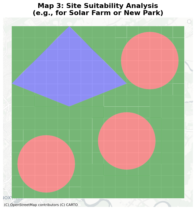
1. Environmental Analyst & Conservation Specialist
Protecting our planet requires sophisticated analysis. Environmental analysts use GIS to model climate change impacts, track deforestation, monitor pollution, and manage natural resources. Imagine using GIS to:
- Model flood risk for coastal communities.
- Track wildlife migration patterns to inform conservation strategies.
- Perform site suitability analysis for renewable energy projects, like finding the optimal location for a new solar farm.
This role combines scientific understanding with powerful spatial tools to drive real-world ecological solutions.
2. Urban Planner & Public Policy Professional
Building the cities of tomorrow—or improving existing ones—hinges on spatial data. Urban planners use GIS to analyze population density, plan new infrastructure, assess land use, and locate optimal sites for schools, hospitals, or parks. GIS helps visualize the impact of policy decisions before they’re implemented, leading to more sustainable and equitable urban development.
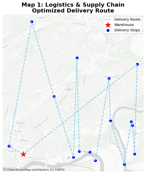
3. Logistics & Supply Chain Manager
Efficiency is king in logistics. Companies like UPS and Amazon rely on GIS to optimize delivery routes, manage complex supply chains, track fleets in real time, and identify the most efficient locations for warehouses and distribution centers. If you’re fascinated by operational efficiency and problem-solving, GIS in logistics is a dynamic field.
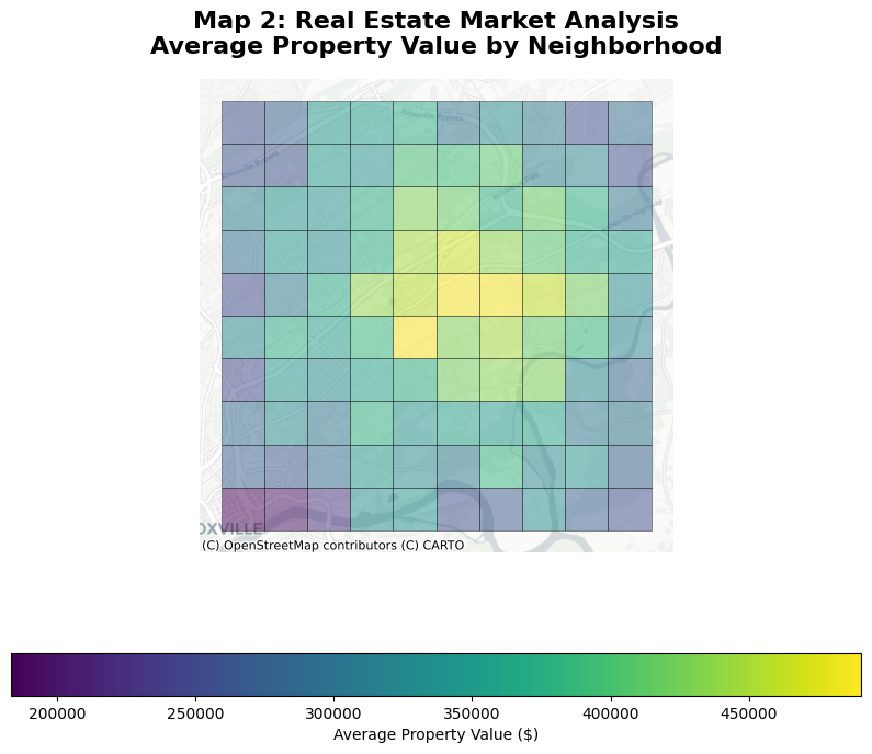
4. Real Estate Developer & Market Analyst
For real estate, location is everything. Professionals use GIS to analyze property values, assess neighborhood demographics, identify market trends, and visualize key amenities like schools and transport links. Whether you’re a developer finding the next hotspot or an investor assessing risk, GIS provides a powerful edge in understanding the spatial economics of property.
5. Marketing Analyst & Location Intelligence Specialist
Understanding where your customers are—and why they buy in certain locations—is crucial. Marketing analysts leverage GIS for location analytics to segment audiences by geographic behavior, plan targeted advertising campaigns, identify optimal store locations, and understand the reach of their brand. It’s about putting your message in the right place, at the right time.
6. Public Health Official & Epidemiologist
Mapping disease outbreaks, identifying “food deserts,” and allocating medical resources effectively are just a few ways GIS saves lives. Public health professionals use spatial analysis to understand the geographic spread of illnesses, identify vulnerable populations, and plan interventions. It’s a field where your GIS skills can have a profound societal impact.
7. Data Scientist (Spatial Emphasis)
The evolution of the traditional data scientist. These professionals combine advanced programming skills (Python, R) and machine learning with GIS to build predictive models that incorporate location as a key variable—predicting traffic congestion, forecasting crime hotspots, or modeling voter turnout. This is the cutting edge of data analysis, demanding both coding and spatial expertise.
Your Fast Track to GIS Mastery
The common thread among all these careers is that GIS empowers you to turn raw, often overwhelming data into clear, actionable, and visual insights. It’s no longer a niche tool—it’s a core competency for modern professionals.
You don’t need another multi-year degree to gain these high-demand skills. What you need is a focused, project-based approach that teaches you the essential 20% of GIS that delivers 80% of real-world results.
Ready to Transform Your Career?
👉 Join the PhD in a Day: GIS Waitlist — and start mastering the skills that open doors to high-impact, data-driven careers.
In this focused module, you’ll use QGIS (free software!) to perform a real-world Site Suitability Analysis for a solar farm. It’s the perfect way to prove how quickly you can master powerful GIS techniques.